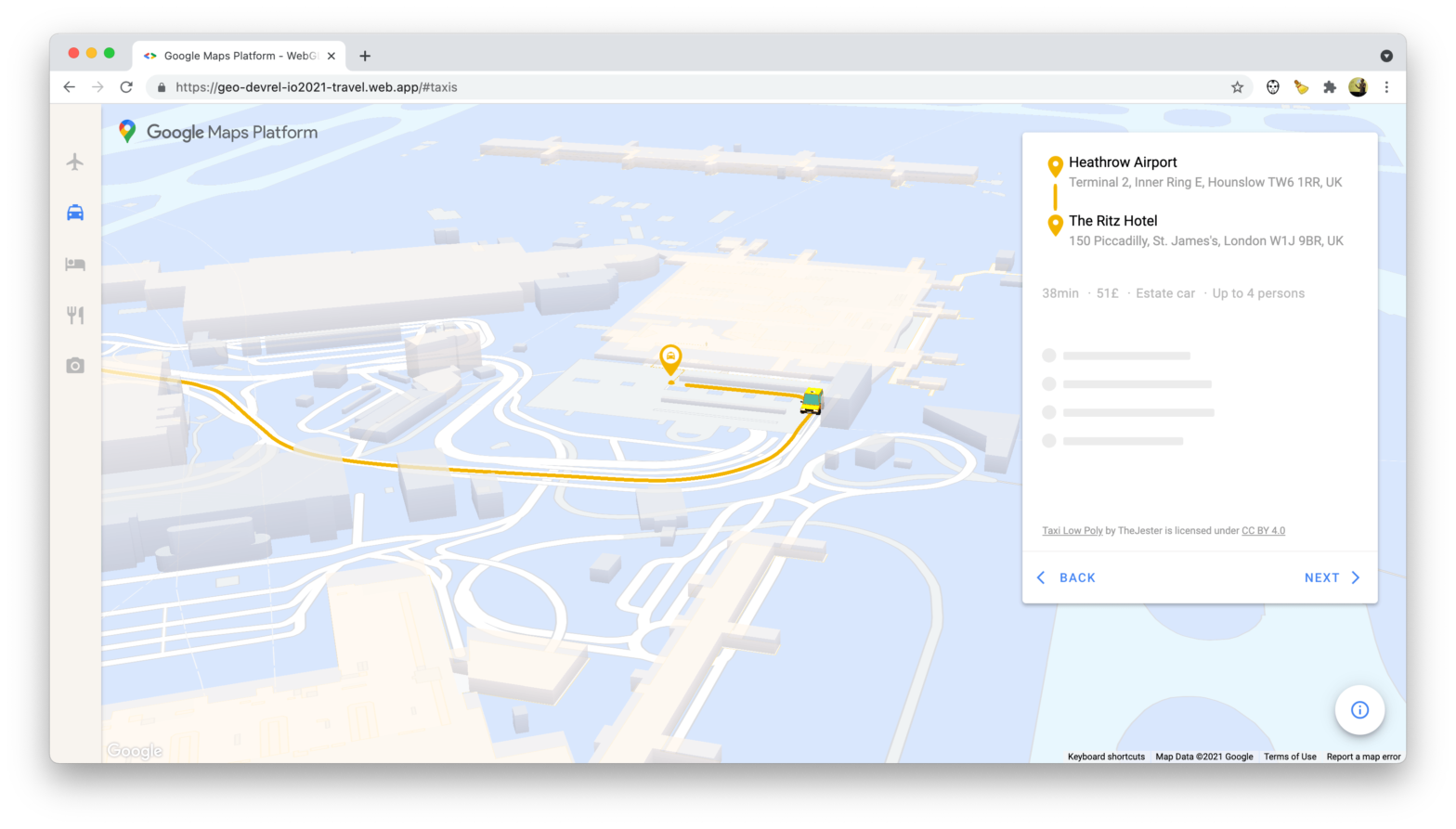
99 second hand smartphones are transported in a handcart to generate virtual traffic jam in Google Maps. Through this activity, it is possible to turn a green street red which has an impact in the physical world by navigating cars on another route to avoid being stuck in traffic.
In succession to Google Maps’s Quiet Transformation, a new – and very extensive and highly interesting – comparison by the same author. He start off by taking a look at the level of detail when it comes to buildings.
But these buildings are more than just a pretty detail—they appear to be the foundation for one of Google Maps’s newest features…
The fun part begins when you start combining these building shapes with places (such as restaurants, coffee shops, etc.) to create “Areas of Interest” which represent commercial corridors. These AOIs are coloured differently on a map, allowing you to quickly recognise ‘m by just glancing at the map.
What about Apple Maps?
With “Areas of Interest”, Google has a feature that Apple doesn’t have. But it’s unclear if Apple could add this feature to its map in the near future.
The challenge for Apple is that AOIs aren’t collected—they’re created. And Apple appears to be missing the ingredients to create AOIs at the same quality, coverage, and scale as Google.
And “Areas of Interest” is just one of the things the author covers …
Combining the feedback from the related issues on GitHub (#52, #778, and #929) I’ve created a standalone component that does exactly that.
The MapViewDirections component can route between an origin and destination coordinate. As routing is handled by the Google Maps Directions API, an apikey for use with Google Maps is also required:
Once the directions in between both coordinates has been fetched, a MapView.Polyline between the two will be drawn. Therefore all MapView.Polyline props – except for coordinates – are also accepted.
On a React Native project I’m currently working on, I’m implementing native (vector) mapviews. Gladly there’s react-native-maps by AirBnB to handle it all.
The aforementioned Sad Topographies reminded me of The Jefferson Grid, an Instagram account curating a list of areal photos depicting a grid with cells the size of one square mile each, spread throughout the United States.
Looking from the window seat on a long plane flight, you might have noticed that large swaths of the United States are divided into a latticework of farms, towns and forests. The cells of that grid, each one mile to a side, are the visible result of a land planning system first proposed by Thomas Jefferson more than two centuries ago.
Welcome to The Nose of El Capitan, in Yosemite National Park — the most iconic rock climb on earth. Tighten your harness and double-check your knot, to join Lynn Hill, Alex Honnold, and Tommy Caldwell on a 3,000 foot interactive journey up El Capitan.