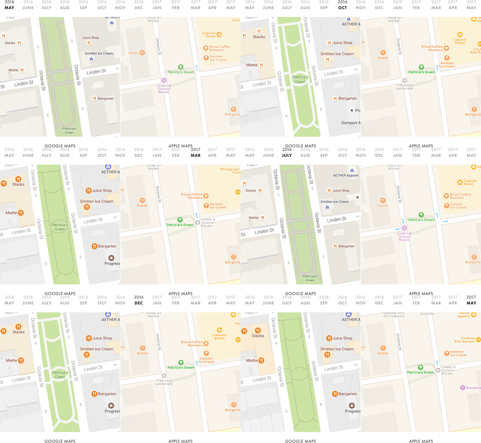
Justin O’Beirne kept an eye on how a specific area evolved on Google Maps and on Apple Maps over time:
Patricia’s Green is the centerpiece of a vibrant and trendy neighborhood in central San Francisco, just blocks away from City Hall.
I wrote a script that takes monthly screenshots of Google and Apple Maps. Thirteen months later, we now have a year’s worth of images
On Apple Maps, the area looks much as it did a year ago. But it’s quite a different story on Google Maps: as the months went on, Google continued adding detail.
As a mapping aficionado, I’m intrigued by this kind of stuff 🙂
Leave a comment