MapItOut: “How far could I live from X?”

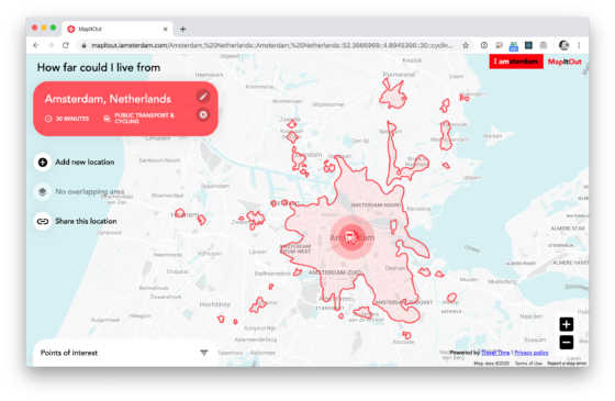
The folks at IAmsterdam have released a map that measures distances not in miles / kms but in time. Select a spot + a means of transportation + a desired travel time and it’ll show you how far away (in time) you can get.

From what I can tell European countries such as Belgium, France, Germany, etc. are also supported but New York (USA) and London (UK) for example aren’t.

MapItOut →

Published by Bramus!

Bramus is a frontend web developer from Belgium, working as a Chrome Developer Relations Engineer at Google. From the moment he discovered view-source at the age of 14 (way back in 1997), he fell in love with the web and has been tinkering with it ever since (more …)

Leave a comment

Your email address will not be published. Required fields are marked *

This site uses Akismet to reduce spam. Learn how your comment data is processed.