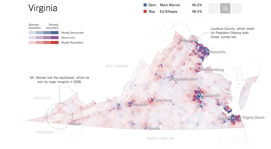
Why are we so confident these are the most detailed maps you’ll ever see from the 2014 Senate elections? Precincts are the smallest level of geography for publicly-reported election results. There were more than 175,000 precincts in the United States in 2012, fifty times the number of counties. The maps here show precinct-level results, where available, from some of the closest Senate races.
Yes, those are zoomable. Built using D3.js and TopoJSON by @mbostock himself.
The Most Detailed Maps You’ll See From the Midterm Elections →
New to D3 and TopoJSON? Check out Let’s Make a Map to get you started.