Lights at Sea — A map of Lighthouses

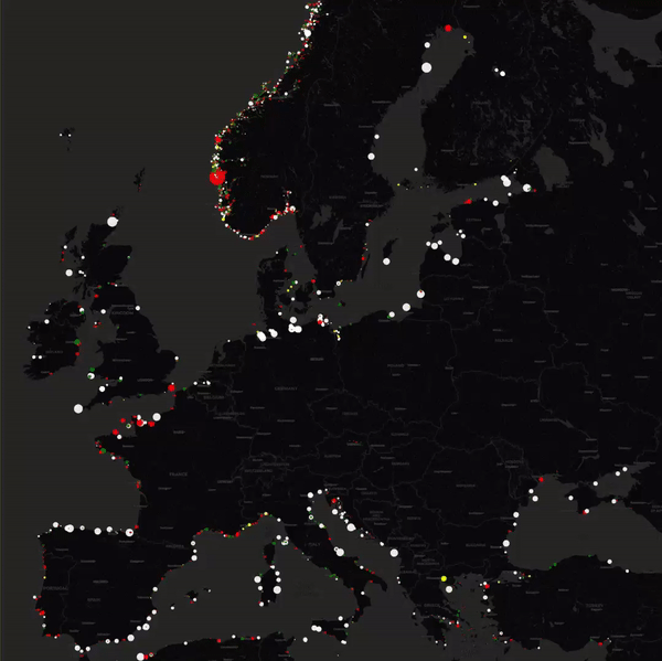
This map shows all the blinking beacons from OpenStreetMap. More specifically, it asks the Overpass API for all elements with an seamark:light:sequence attribute, decodes these, and displays them as coloured circles on the map using Leaflet. It also tries to take the seamark:light:range and seamark:light:colour into account.

The cool part is that the size and colors of the dots are accurate, as are the blinking patterns.

LighthouseMap →

Published by Bramus!

Bramus is a frontend web developer from Belgium, working as a Chrome Developer Relations Engineer at Google. From the moment he discovered view-source at the age of 14 (way back in 1997), he fell in love with the web and has been tinkering with it ever since (more …)

Leave a comment

Your email address will not be published. Required fields are marked *

This site uses Akismet to reduce spam. Learn how your comment data is processed.