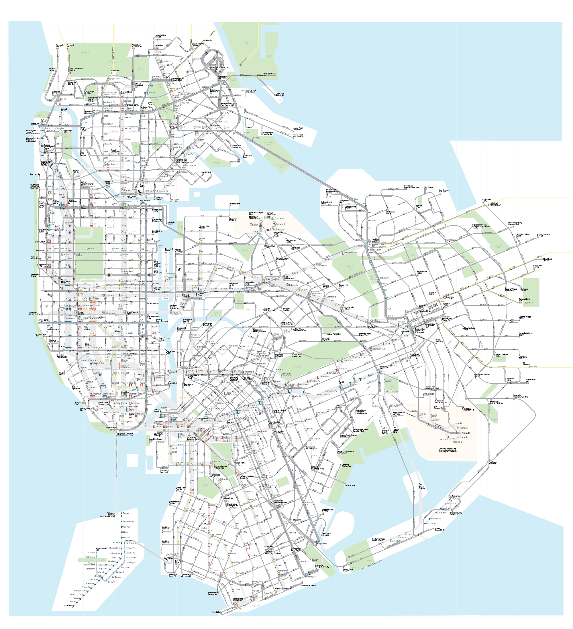
Anthony Denaro:
Looking at The Subway Map the thought hit me: If I can transfer to the bus for free, why isn’t there a map that shows where to connect with buses? Why does the system map only show subways?
[…]
The whole system of buses and subways could fit on one map. It could work. Right?
The result is one impressive, and good looking, map:
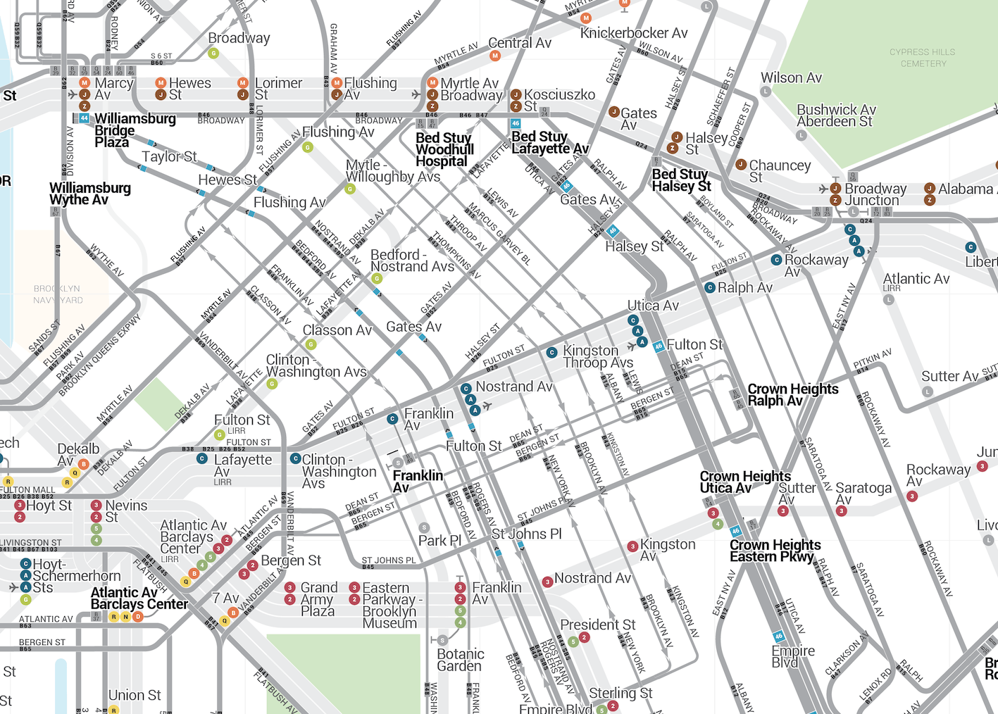
Mapping Brooklyn (detail above) was the hardest part:
Brooklyn’s street layout requires the need for a incremental angle grid. This influenced how the rest of the city would be laid out. I started out using 45/90 angles. I found this to be too rigid to accurately display the entire city.
[…]
I ended landing on a 22.5/45/90 degrees. 22.5 is the magic number that made this project work. It afforded the right subsect of minor angled lines at 22.5/67.5/112.5 degrees. This kept the map looking neat enough.