MapIt – Map geographical points to administrative areas

mapit

MapIt is useful for anyone who has the co-ordinates of a point on Earth, and who needs to find out what country, region, city, constituency, or state it lies within. It’s also great for looking up the shapes of all those boundaries.

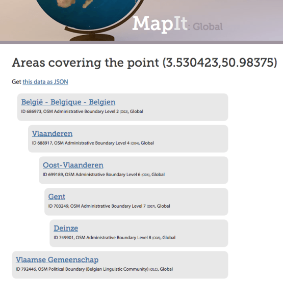
Above is a screenshot using the coordinates of my hometown Deinze. Data also available as JSON. Defaults to EPSG:4326 (WGS84), but that also can be changed.

MapIt →

Want to know more about this EPSG:4326 thing (and more)?
I’ve got you covered.

Published by Bramus!

Bramus is a frontend web developer from Belgium, working as a Chrome Developer Relations Engineer at Google. From the moment he discovered view-source at the age of 14 (way back in 1997), he fell in love with the web and has been tinkering with it ever since (more …)

Leave a comment

Your email address will not be published. Required fields are marked *

This site uses Akismet to reduce spam. Learn how your comment data is processed.