Spy Viewer – View Historic Mapping within a Spyglass Circle

Ooh I like this: The National Library of Scotland has released Spy Viewer, a tool showcasing a set of historic which maps have been georeferenced so that they line up perfectly on top of the current maps. Using a circular spyglass interface you can watch the old maps peek through.

Pictured below is a historic glance at London’s Tower Bridge:

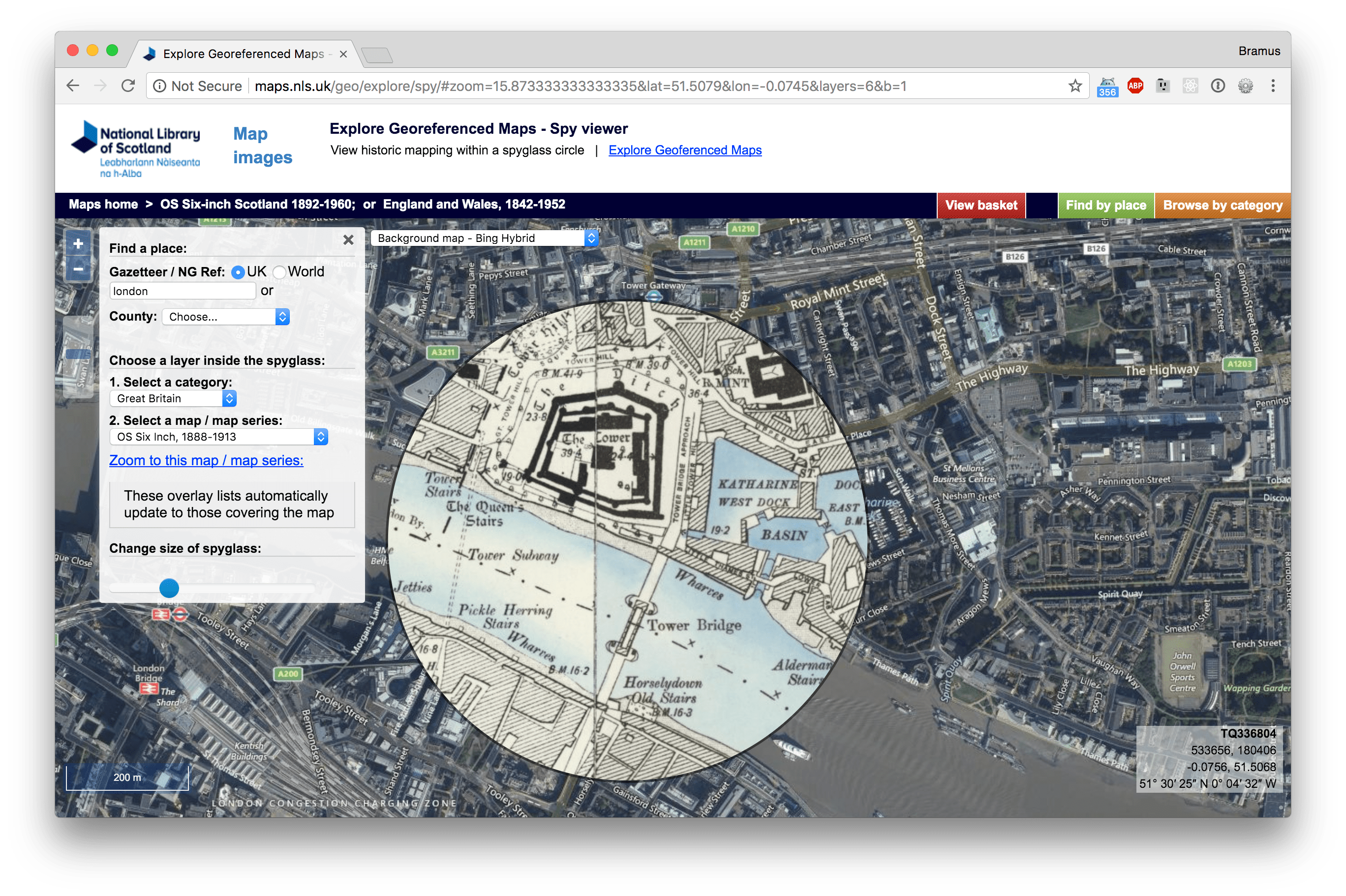
Don’t let the fact that it’s a tool by the National Library of Scotland fool you: other maps of other parts of the world are also available (select yours using the category dropdown)

Spy Viewer →

Published by Bramus!

Bramus is a frontend web developer from Belgium, working as a Chrome Developer Relations Engineer at Google. From the moment he discovered view-source at the age of 14 (way back in 1997), he fell in love with the web and has been tinkering with it ever since (more …)

Leave a comment

Your email address will not be published. Required fields are marked *

This site uses Akismet to reduce spam. Learn how your comment data is processed.